Vanjiyur Fm
Type Locality and Naming
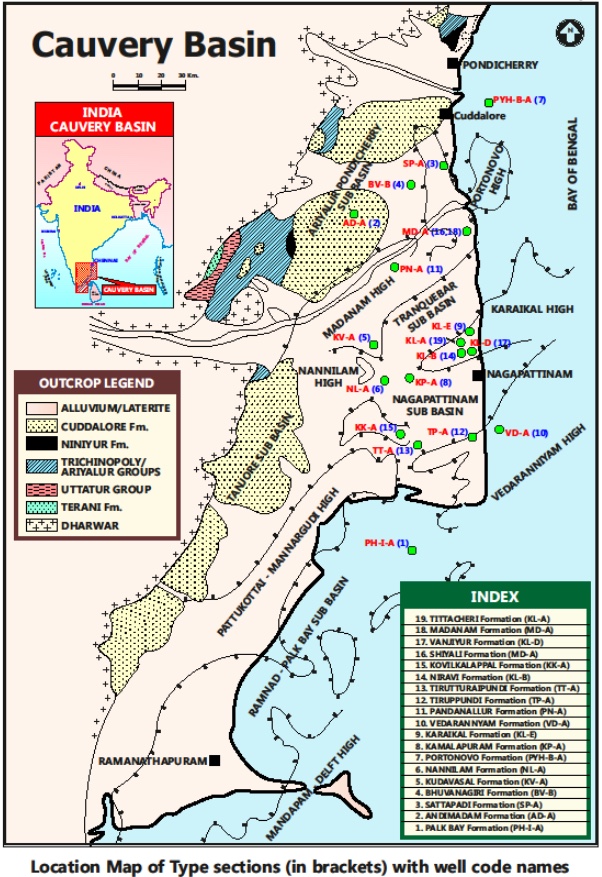
SUBSURFACE: The type section is located at exploratory well Karaikal-D (depth interval: 640-575 m), in the Nagapattinam subbasin. The hypostratotype is in the well Tiruvarur-A (depth interval: 750-595 m). It was named after the Vanjiyur village by ONGC team steered by Venkatarengan et al.(1993) and was issued as Document-VII by KDMIPE, ONGC, Dehradun (1993).
[Figure 1: Type-section Map of Subsurface Formations]
Lithology and Thickness
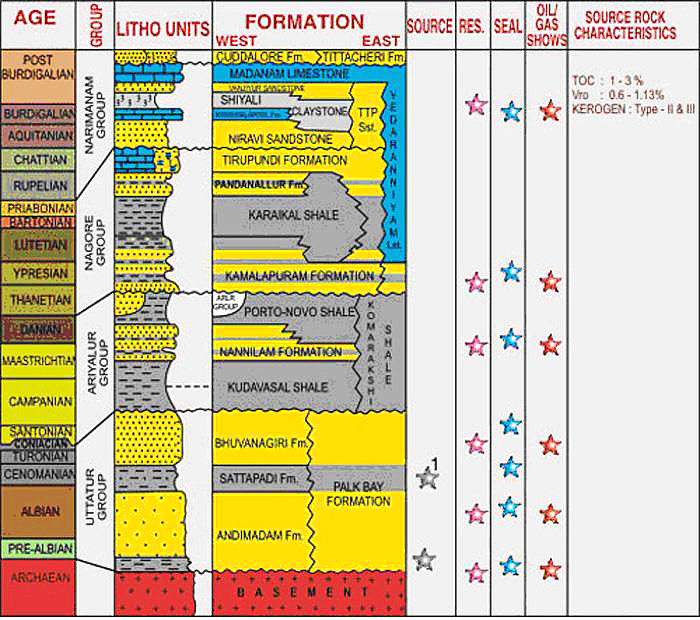
Sandstone. It is predominantly sandstone with occasional siltstone and calcareous matter. The sandstone is greenish white, hard, compact, fine, subangular and cemented by calcareous matrix. It is richly fossiliferous. the siltstone is dark gray to black, moderately hard and compact, calcareous and fossiliferous. Its thickness varies from 65-155 m. Part of Narimanam Gr.
[Figure 2: Generalized Stratigraphy and Petroleum System of Cauvery Basin (from dghindia.gov.in)]
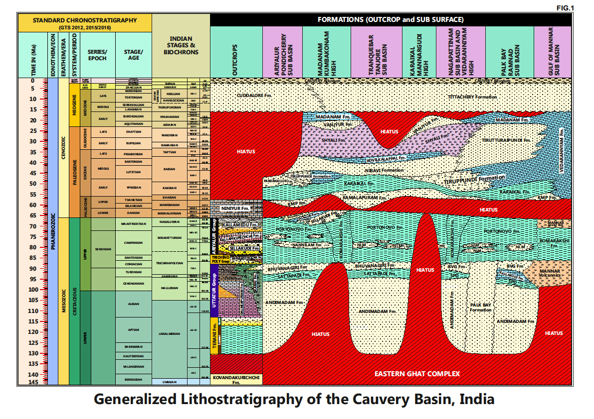
[Figure 3: Generalized Stratigraphy of Cauvery Basin (Provided by A. Nallapa Reddy & R. Nagendra)]
Relationships and Distribution
Lower contact
Upper contact
Conformable with the Madanam Fm.
Regional extent
This lithologic unit is confined to Karaikal Ridge and parts of the Tranquebar sub-basin.
GeoJSON
Fossils
Miogypsinoides (M.) complanata, M. formosensis, Globigerina angulisuturalis and Turborotalia opima.
Age
Depositional setting
Inner to Middle neritic.
Additional Information
This unit was first reported by R. P Rao et l. (1972) in ‘Progress report on studies in the Cauvery and Godavari basins (Field season 1971-72), unpublished ONGC report, and later Venkatarengan et al. (1993) have adopted as-is.


